Three Tree Point Race: #Three in the Center Sound Series
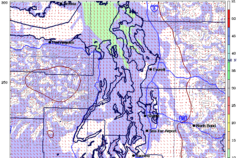
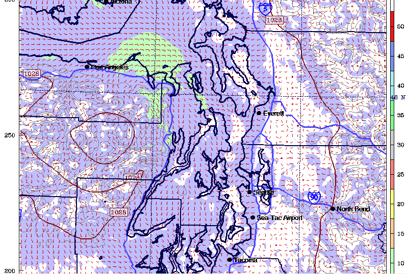
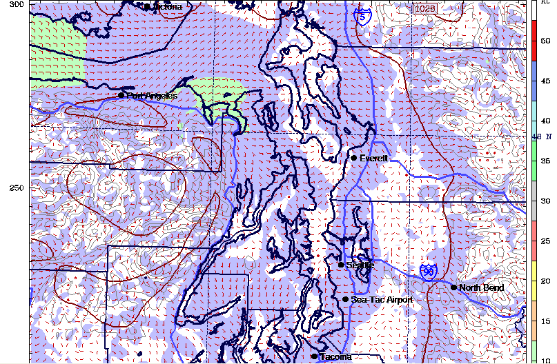
Well it looks like Blakely Rock is going to be the best race of the series as you can see from the forecast charts. 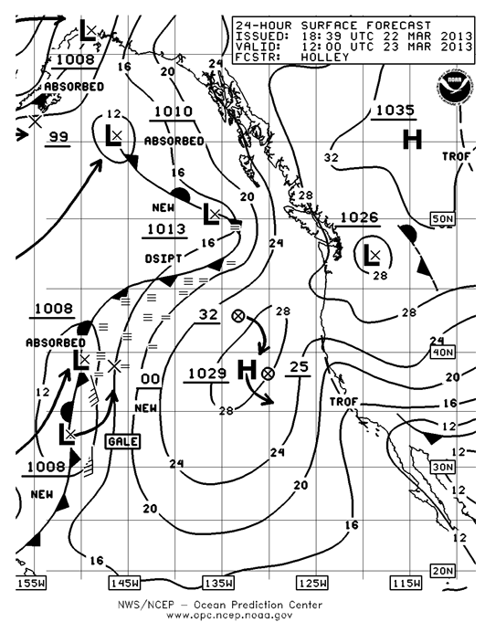 We had some wild weather yesterday which carried over through the morning hours with some very un-spring like accumulations of snow in the convergence zone north of Seattle. As the chart shows for Saturday morning we will be between weather systems with the remnants of a deteriorating low to the east of us and a weak high pressure system in the north Pacific.
Following the old rule of thumb, the first day that the ridge of high pressure starts to build over the Northwest is the day you will have the best breeze from the north. Unfortunately between two weak systems you won’t have much of a ridge developing. You can also see from chart of current conditions that there is almost zero pressure gradient over the Pacific Northwest. You see from the green numbers on the chart there is a pressure reading of 1027.1 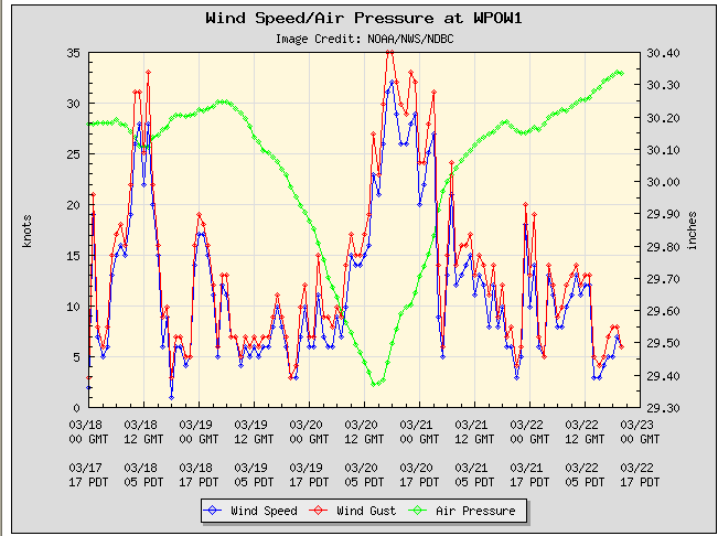 in Bellingham,
 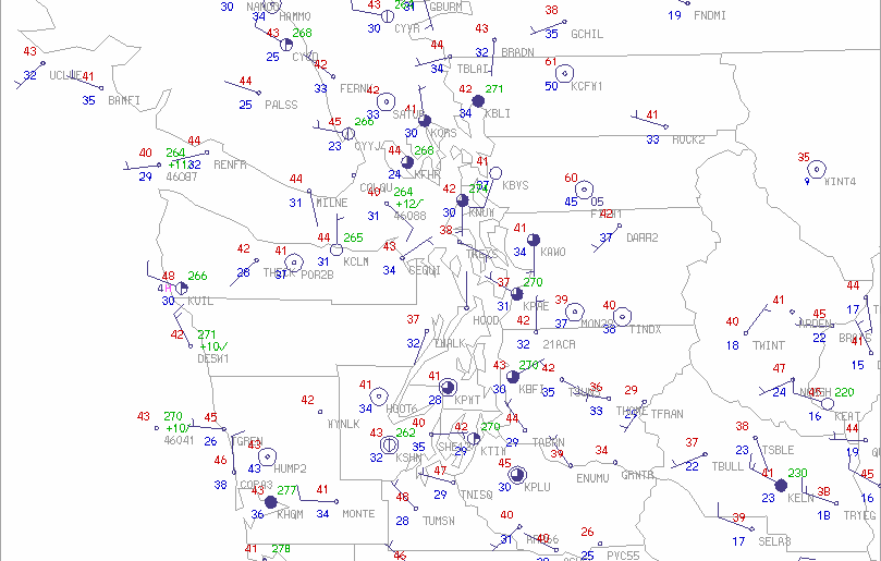 note that the first two digits are left off on purpose in all the pressure readings on this chart. In Tacoma the pressure is 1027.0 so there is only a difference of .1 millibars. Pressure is higher in Bellingham which is why there is currently a northerly at West Point of six knots. So where does this breeze come from when the NWS forecast is calling for a southerly?
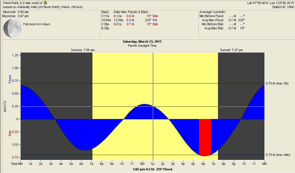
 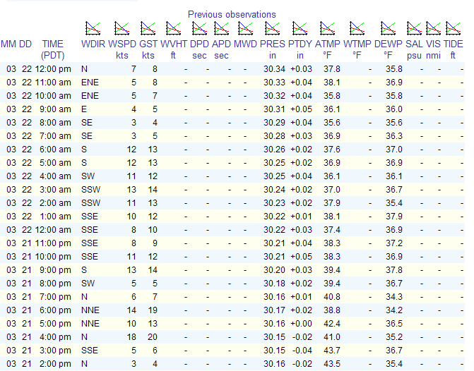 The answer is the Swihart Effect which says that in the absence of a pressure gradient over Puget Sound combined with the heating of the land masses around the Sound this can bring a northerly down the Sound coinciding with the start of the flood tide. Notice on the Previous Observations chart that the southerly breeze started to die as the ebb went to slack and that the breeze went to the east northeast at 1000am which was thirty minutes after the tide started to flood and the breeze backed around to the NNW and built (and I use the term loosely) to seven knots by 1200-1330 hours which coincided with max flood and the continued clearing of the overcast over the Puget Sound. As the flood went to slack, the northerly started to back off and is now down to five knots at West Point. From up on the bluff at Magnolia at 1300 hours today you can see that there was little to no wind south of West Point.
As with all Three Tree Point races it pays to know where you are on the Race Course at all times, keep your head out of the boat to watch not only the weather but also where your competition is going. You’ll start gathering your weather info before you leave house looking at West Point weather, the chart of pressure gradient versus wind strength, Washington State Ferry observations in the central Sound and what the actual pressure gradient is over the Northwest.
Once again for tomorrow have enough fuel on board to power home from Three Tree Point as CYC has been known to end the race down there. Put your sunblock on before you leave the house and make sure you have your good sunglasses.
On the boat have the light air sheets rigged and make sure you have your barber haulers set up for the headsail so you can move the lead outboard and forward quickly and easily. If you get the chance you might just check out what Kirk Utter has setup on Scimitar for this situation, very cool.
As you can see from the prog charts this could be the classic Puget Sound sucker race with enough wind to start but dropping over the course of the day. Luckily the tides will be with us but they will be the very small tides of the day.
As far as tactics go, it will start getting light and shifty by about noon so don’t get too far into the corners of the course. Beyond that, be ready for anything.
Wish I had a better forecast for you however it is after all springtime in the Pacific Northwest.
See you out there. BH
