Scatchet Head Race: Number two in the Center Sound Series
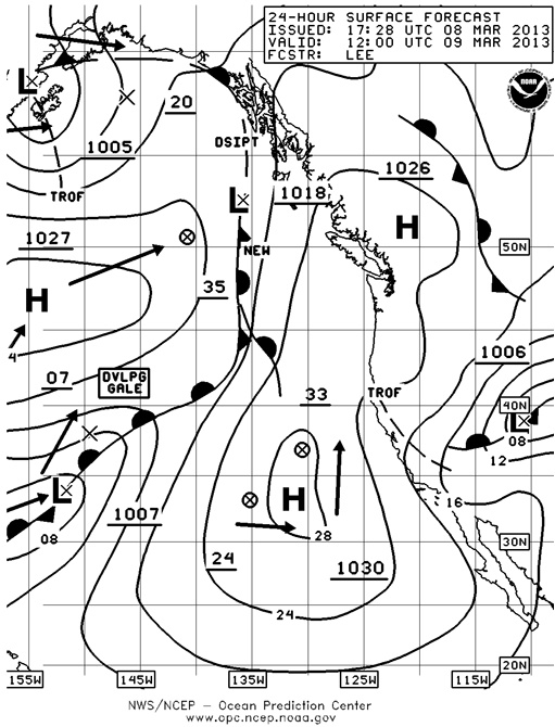
Last week was just too good to be true. Fairly steady breeze, not a lot of anti-water, not too cold, and not much rain. Oh well, it is springtime in the Pacific Northwest. This weekend will be completely different. It will be sunny, be sure to put on lots of sunblock BEFORE you leave the house, and dig out those great Maui Jim sunglasses, the ones that have the heads-up display embedded in them showing green arrows for lifts and red arrows for knocks, you’re going to need them. All you have to do is look at the surface forecast chart and with the high centered smack dab over Puget Sound you know there won’t be much wind.
(Click on images to see larger versions)
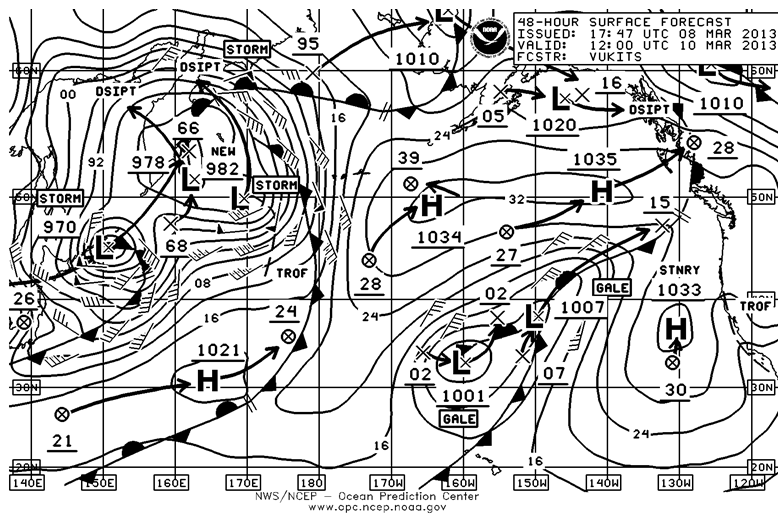
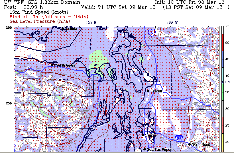
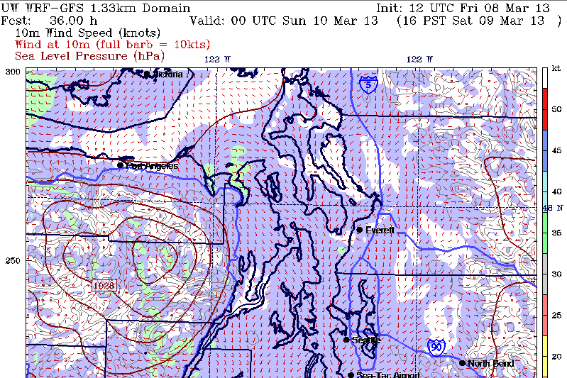
The forecast charts from MM5 at the UW show the same thing with generally five knots of wind or less from the south southeast. The 48 hr Surface Forecast Chart is much more interesting.
The only problem is we won’t be sailing in the North Pacific.
This would be a prime opportunity for the CYC Race Committee to exercise their authority and set an alternative course that would at least allow us to finish.
The easy thing for the Race Committee to do would be to look at the weather in the morning, specifically the pressure gradient from Bellingham south to Sand Point(NOAA Seattle) and south to Portland and see if one exists. You can get this from the internet http://www.atmos.washington.edu/cgi-bin/latest.cgi?sfcplots-wwa or from VHF weather. If it’s less than 1 millibar set the new course. They should also check the wind readings on the WS Ferry runs for near real time readings. http://i90.atmos.washington.edu/ferry/Ferryjs/mainframe1.htm
Needless to say, if you’re racing you’re going to want this information as well and from the moment you get to the boat you’ll probably want to write it down so can track the changes over the course of the day.
Tides, Wind and Tactics.
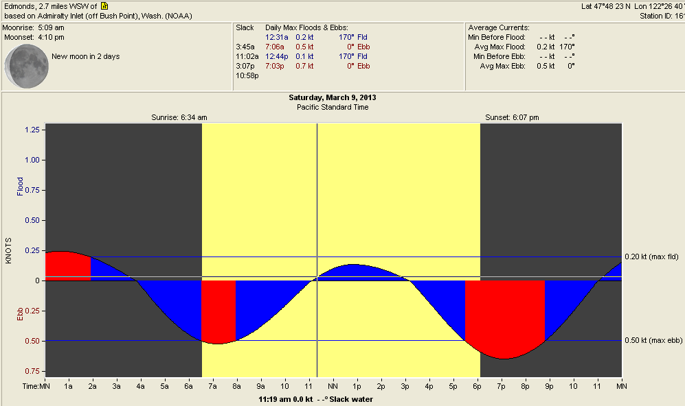
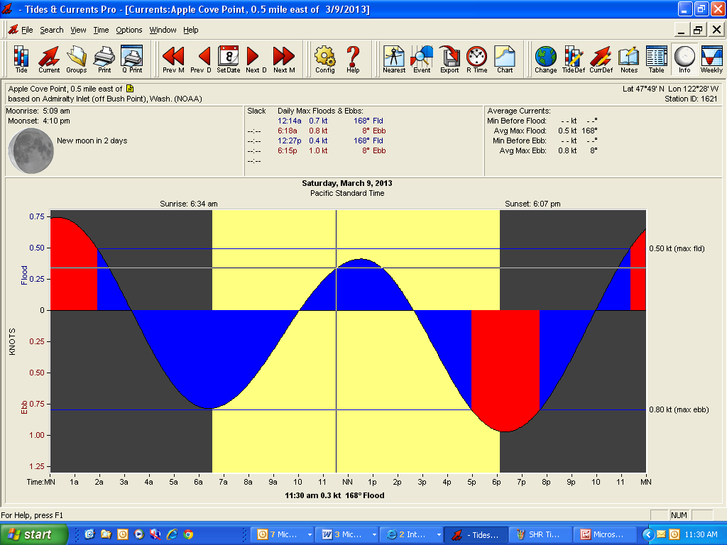
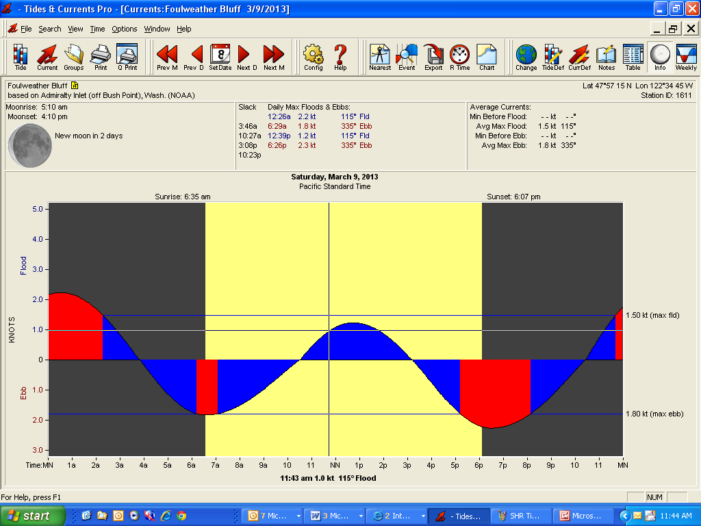
We will be starting just after the small flood tide of the day starts which off of Edmonds will reach a maximum of about a tenth of a knot. If you’re thinking of going over to the Kingston side of the course, the current at Apple Cove Point will be stronger at about .4 knots. Either way, in five knots of wind or less it’s going to tough sledding running north.
The other problem will occur at the mark at Scatchet Head which can be a challenge in the best of conditions. In the flood and the ebb the flow accelerates over the bar that extends south from Scatchet Head. While there are no current stations for Scatchet Head you can use the one for Foulweather Bluff and it will be fairly close. The important item to remember is that as you approach the mark, the current velocity will almost double in the last ¼ to ½ mile of the mark. Combine that with the fact that with the Bluff so close to buoy, if there is a southerly and the day dawned clear with the Bluff heating up as you sail towards it, the wind will start to lift off the water leaving the mark in a hole.
You round the mark to port and if you see the vessels ahead of you being swept to the east and unable to round the mark, start putting plenty in the bank early so that when one of those errant puffs makes it through, you’re in a position to take it around the mark. In the past there have been times when it even pays to have the lunch hook ready.
The next challenge will be that the ebb will be starting around 1500 hrs and if there’s a southerly and you’re beating south to the finish line the question becomes do you go to the east or the west? The ebb will start first on the west side and if you go there, you’ll have to cross the ebb twice depending upon when you round the mark.
If you can round in the flood, you will probably be better off getting over to the Edmonds side and working down that shore. Again, know who the smart guys are in your class and take note of where they are going.
The current wind projections show a fairly consistent five knots of wind or less from the south for the entire day. In these velocities you can expect fairly large shifts as well as some unexpected holes to show up just about any where on the course. The reason for this is again related to how much warming will be occurring over the land masses. When warming occurs, the boundary layer next to water will be slower and from 10-15degrees off the direction at the top of the mast. This boundary layer is not of consistent thickness and as result you can have the swiss cheese effect meaning that this breeze will have holes in it. The boats with the taller masts will definitely have an advantage as there is simply more wind the further off the water you can get.
As the day progresses, i.e. after 1600 hours, the breeze will tend more to the south southeast as the next front starts to move closer to the coast. This will favor boats on the inside of the lift on port tack while going south on the east side of Puget Sound. These boats will also be out of the big ebb of the day.
How to prep for a light and shifty day on Putrid Sound.
The first thing will be to make the boat as light as legally possible. Minimum water in the tanks, just enough fuel to get home from Scatchet Head, and keep the number of crew to an absolute minimum. Don’t let the crew haul huge duffle bags full of crap onto the boat and you’re certainly not going to need #3’s, #4’s, or 1.5oz chutes. Know your course to the mark and know the course to finish. Track the median wind so you’ll know when to gybe or tack and watch the cog and sog. The time limit is nine hours from the start of your class so keep that calculation handy and when you have to average six knots or more vmg going upwind, pull the plug and get to the Clubhouse.
No predictions this week as conditions will be just too flukey. You can however bet that I’ll have a bunch for Three Tree Point.
