 I may be the last Brief of 2014 however that doesn’t mean it isn’t interesting. I would also like to welcome Rainwise Weather Instruments to Bruce’s Briefs. They’ve been building high quality weather stations since 1974 with the development and patenting of the first tipping bucket rain gauge. In 1981 they developed the first digital electronic home weather station, the WS-1000. This was followed in 1996 with the first wireless, solar powered consumer weather station, the WS-2000. Innovation continued with the introduction in 2006 of the MK-lll-Long Range weather station – the first consumer wireless weather station to have a 1-mile, line-of-site transmission. Since that time they have led the way with a number of very interesting weather monitoring packages for both home and industrial applications. If you’re thinking about a home weather station or one for the office feel free to give Rainwise West a call at 206-612-5177. This is also not related to King Counties RainWise program. Rainwise will also be providing a Rainwise Weather Summary with the high and low temperatures, peak gust, and high and low pressure readings for the month in the Seattle area.
Click on any image to enlarge.
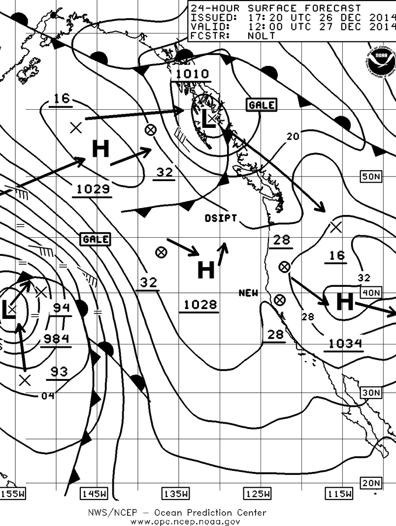

As we mentioned last week it appeared that while we have been behind month to date for rainfall, we were going to make it up and that we did by almost .2” as of today. We’re still over 12” ahead for the year and I’ll guarantee that isn’t going to change much. So will that hold up for the end of the month? We’ll see however it looks promising as you can see with the surface forecast chart for Saturday which shows another low pressure system with associated cold front getting ready to drag over us and drop more rain. This one is also coming down from the northwest which means it is going to be bringing some cooler air with it which should finally provide some snow in the mountains for you skiers.
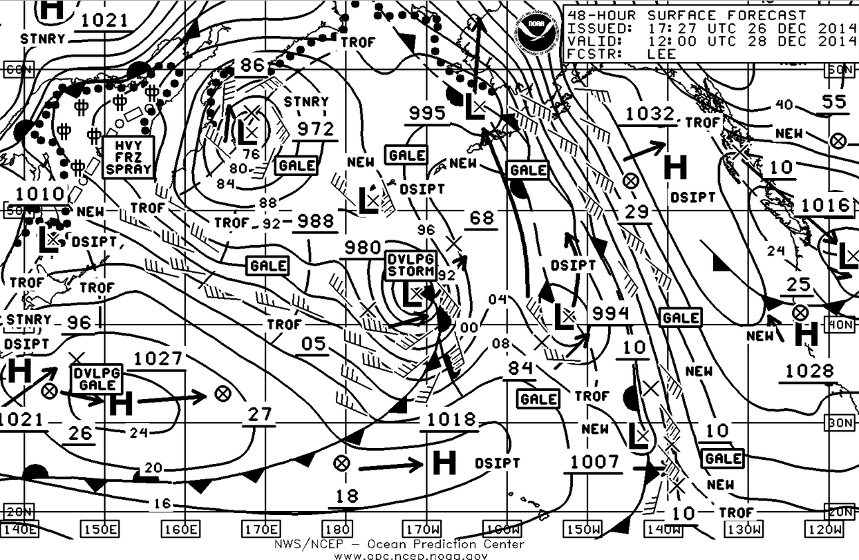
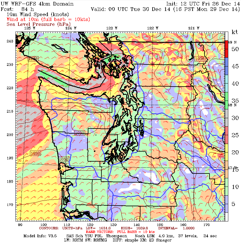
The Sunday surface chart shows a 1032 mb high developing off the coast and this is going to be one to watch. A 1032 mb high isn’t unusual in the summer however this time of the year and this far north, it could get interesting. Plus if you look at the Tuesday (96hr chart) you’ll see that this high has strengthened to a whopping 1054 mb which is way higher than we ever see in the summer. If your ears start to pop on Tuesday, you’ll know why. So it will not only be bringing cooler temperatures to us for the coming week it will also act as a low pressure blocker and will be sending those systems and their fronts over the top of the high and into Canada and Alaska. With the high remaining east of the Cascades it will also mean plenty of cold, easterly breeze coming down the Fraser River Valley, into the northern part of Washington (Bellingham, the San Juan Islands etc) and then going out the Straits of Juan de Fuca.
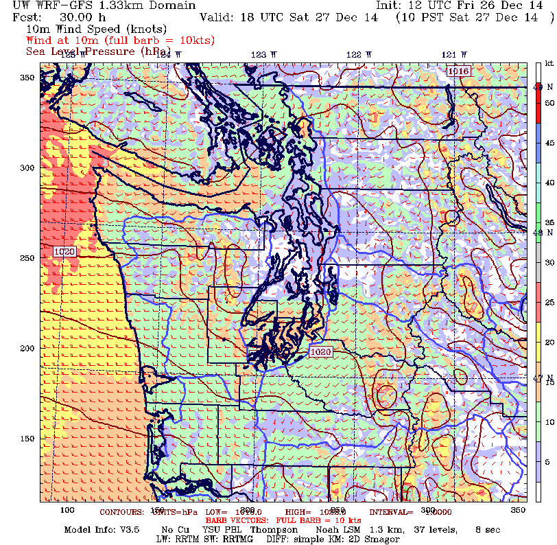
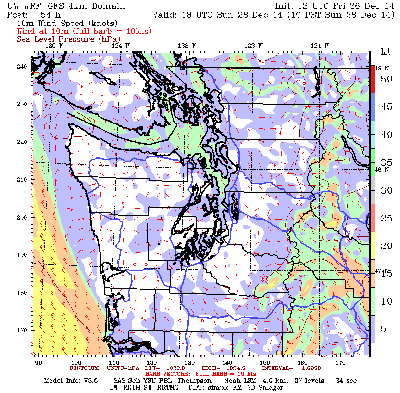
The 1000am Saturday morning chart shows an onshore flow which will be coming down the Straits and around the bottom end of the Olympics, leaving the central Sound with light and variable breeze. By Sunday the breeze will be starting to shift to north-northeast in the north Sound with an easterly developing in the Straits as the pressure starts to build. By Monday afternoon it’s going to cranking in the northern waters. So if your moorage is open to the north-northeast it might be time to get the extra fenders and mooring lines out or maybe move the boat to a more protected mooring.
Have a safe and Happy New Year. And if you’re looking for a more detailed forecast for your event, don’t hesitate to ask. Thank you.
