Needless to say, it’s been a very interesting week of weather. Three days of record high temperatures, a pretty good wind storm, and now we’re going to have a beautiful weekend. A perfect time to go out and enjoy those empty anchorages. Just don’t get used to it.
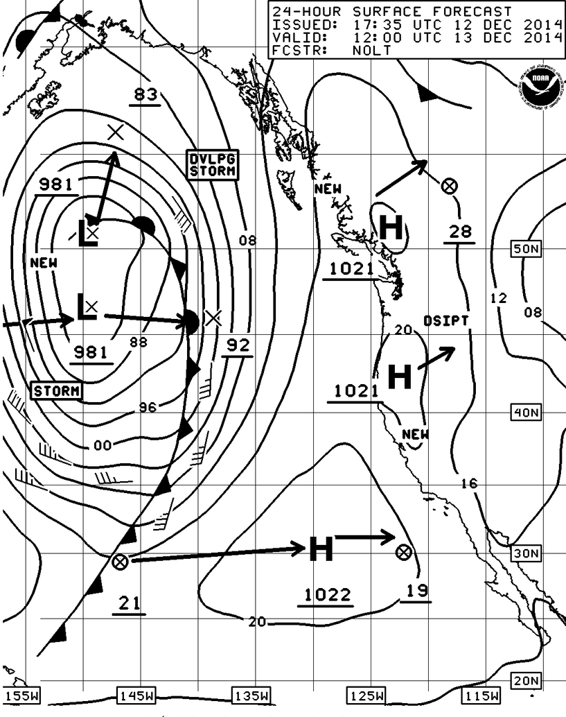
As you can see from the surface forecast charts, Saturday really is going to be fairly nice and while there will be wind (10 or so knots) in the Straits or the San Juan Islands the rest of the Sound will remain relatively calm.
Click on any image to enlarge and scroll.
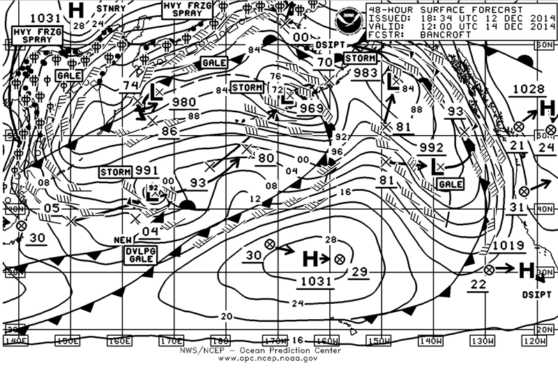
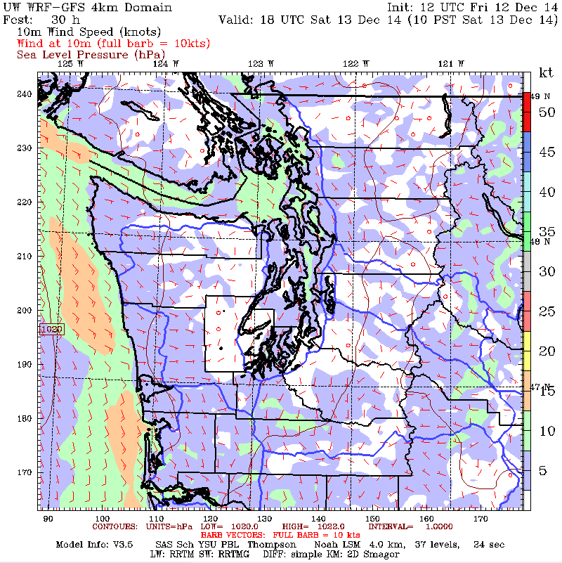
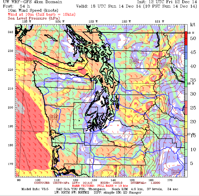
As I said don’t get used to it because by Sunday morning(48 hr Surface Forecast chart) you can see the beginning of another series of fronts headed our way. The U of W MM5 Chart for 1000 hrs on Sunday definitely shows the breeze picking up along the coast, in the Straits, and the north Sound. So if you do go cruising, plan accordingly.
That 48 hour chart is also interesting because it really shows just how active the North Pacific can be this time of the year with an amazing series of low pressure systems with cold fronts all aimed in our general direction.
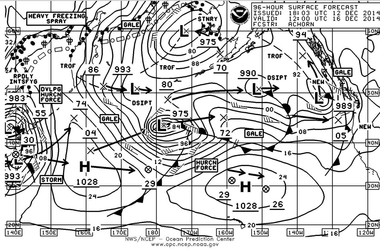
I also included the 96 hour chart as well just so you can see that the progression of low pressure systems really isn’t going to change very much over the course of the week. At this point in the month we are still behind in rainfall but ahead by about a foot for the year. I don’t think we’re going to have much of a problem meeting the December norm. It’s also interesting that these fronts are also going to continue to drag into California and while they got a lot of rain this week, they still need a lot more and could really use a lot of snow in the mountains to help bulk-up the reserves.
Enjoy the weekend and even though the weather may be nice don’t forget to use the extra mooring lines and fenders when you tie the boat up on Sunday.
