This is beginning to sound like a broken record as once again high pressure will dictate conditions in the Pacific Northwest and it will be great for Predicted Log Racing and not so good for sailing. Excellent if you just want to power over to Blake Island, Port Madison or the San Juan’s for a quiet weekend.
As you can see from the forecast charts for Saturday and Sunday, the Putrid Sound will be sandwiched between two areas of high pressure, one 1031mb system in the interior of Canada and one 1023mb system off of Point Conception in the Pacific. Specifically the Sound will be between two 1016mb isobars on Saturday and between a 1020mb and a 1016mb isobar on Sunday that are a long way apart.
Click on any picture to enlarge
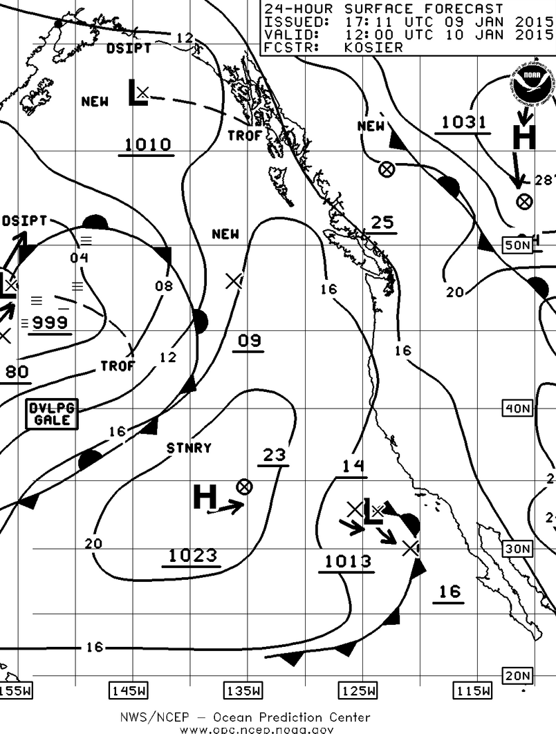

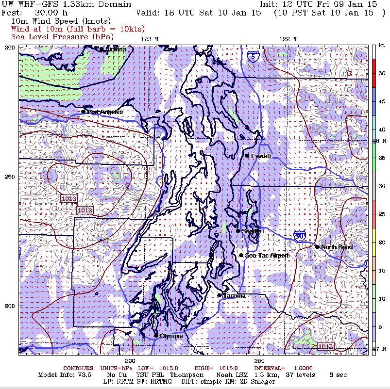

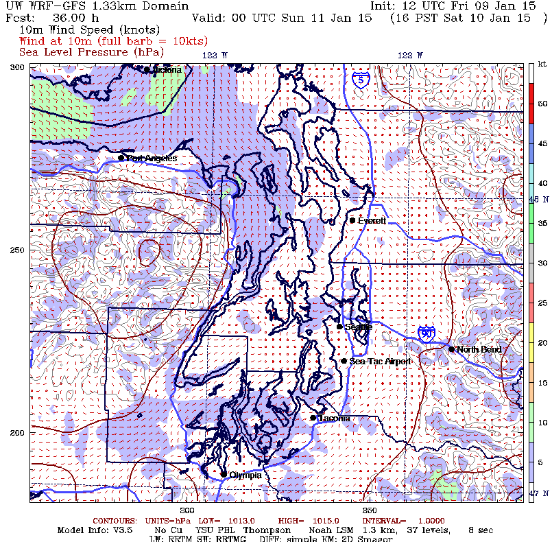
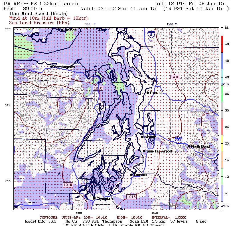
For the Duwamish Head Race this will not be good news especially because of the 1715 start of the Seahawks game. If it stays light you can probably bet that a number of racers will pull the plug sooner rather than later as while there may be wind in the morning, the gradient is going to go very flat over the entire area by mid afternoon. The good news in all of this is that TTPYC has a history of common sense when it comes to shortening the course. They don’t seem to hesitate on this at all. What would be even better would be to post a shorter course where there would be a better chance for at least some wind, say from the start to Three Tree Point (temp “C”), to Point Robinson (temp “J”), back to the temporary mark “H” south of the marina and then to the finish with the ability to shorten at any one of those marks. IMHO. Or maybe there should be an option for a sailboat Predicted Log Race. Run about 12 miles under power and predict when you’re going to finish. Just a thought.
The really interesting part of this is that following the example of the winter Vashon Race, you will be running a reverse course this year which I think is the first time they’ve done this. If the race is to finish at all, the committee will have to shorten the course at Blakely Rock. The challenge for sailors will be picking the place to cross the Sound to get to the west side. In these conditions you will typically find breeze on the edges of the Sound and not so much in the middle so the temptation is to sail with the breeze you have and hope for a crossing path to miraculously appear at some propitious moment. You’ll get some help from the tide with max ebb at Alki being .47 knots at around 1130 hrs. You will also want to be on the west side of the Sound by at least the north end of Vashon so you can pick up the ebb out of Colvos which you can ride that up to the north end of Blake Island and about ½ way between the north end of Blake and Restoration Point on Bainbridge you’ll have the ebb out of Rich Passage until about 1500 hrs. Sunset is at 1638 hrs and then the temperature will start to get to that bone-chilling cold we’ve come to know and love if you sailboat race around here. Please pass the hot buttered rum. A whopping .15 knots of flood tide will occur around 1715 hrs with the next slack arriving at around 1930 hours. All in all, the order of the day will be light air sheets, light air barber haulers, a multiplicity of sail changes going between the #1, the drifter, the code “0”, the ½ oz kite, keeping the dogs in the house, the tactician looking for that next puff and then flawlessly anticipating the next shift.
You’ll want to track the gradient starting this afternoon with the surface pressure readings at Forks, Bellingham, Seattle, Portland, Astoria, North Bend and Wenatchee from your VHF weather or just go to: http://www.atmos.washington.edu/cgi-bin/latest.cgi?sfcplots-wwa
If the numbers are all the same or close like within a couple of 10th’s, that usually isn’t good.
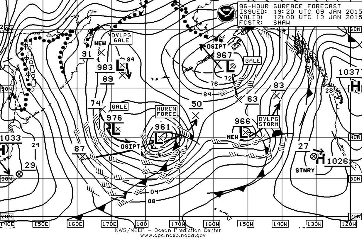
Looking into the future, once again the Tuesday surface forecast chart is pretty interesting as our weather for next week will be dominated by a very large 1037mb high just east of the Cascades which will mean cold temps, more air stagnation, and a continuing lack of snow for skiers. The Pacific may look very active with six different low pressure systems and associated fronts however that 1037mb high is not going to move very much and will drive those systems into northern Canada and southern Alaska.
The good news for the future is that the National Weather Service is FINALLY going to spend the money that Congress has provided for some up to date computing power which will mean they can finally be on at least a par with the European forecasting power which is good out to about eight days. Currently the NWS is really only accurate out to about 72 hours. So look for improved forecasting from the NWS.
Enjoy the weekend and I’ll be watching the race from the house with my binoc’s from in front of the TV with some appropriate beverage in hand.

