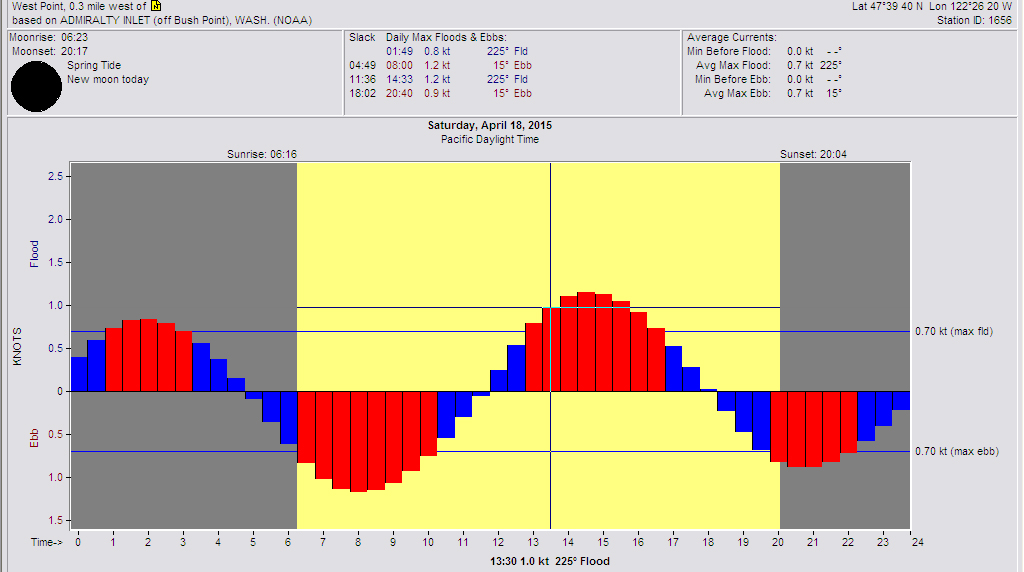
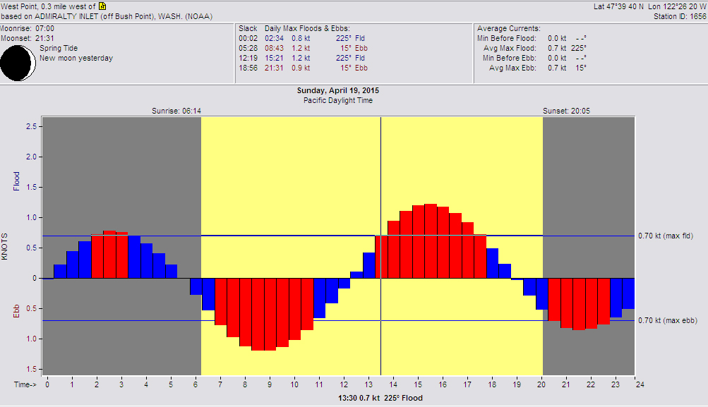
We have had so much incredible sailing this spring, I just keep waiting for something bad to happen. Well, I don’t think it will be this weekend even though the surface forecast charts show very little gradient over the Northwest for the entire weekend. The good news is that this could be another classic example of the Swihart Effect coming into play, at least on Saturday.
On both Saturday and Sunday, we’ll start at just about slack water and we should have a light northerly of about 5-10 knots. This will be the remains of the overnight breeze which will also have a distinct NE component to it like around 20°-30°m. As the tide starts to flood that will bring more wind down the Sound and the breeze should back to 350°-0°m. It’s that transition that will be interesting and going into the big flood of the day, so will the starboard hitch out into the Sound into more tide pay because there will be more wind away from the beach will be the question. There will also be holes that will be difficult to see on the water as these two breezes interact. This is where tacticians will earn their keep.

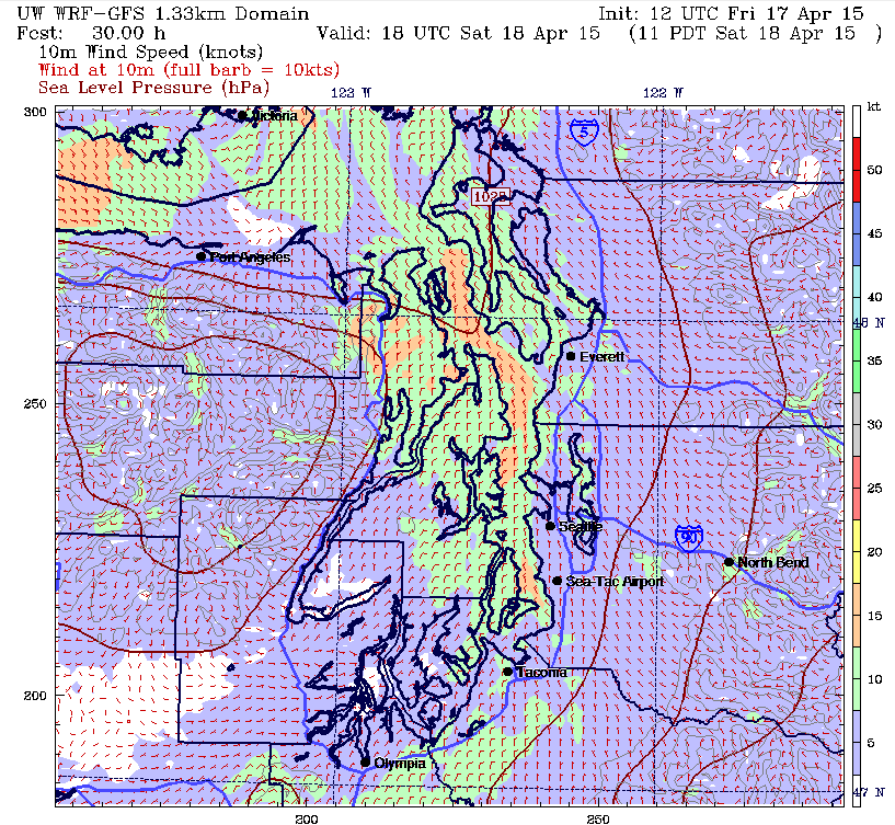
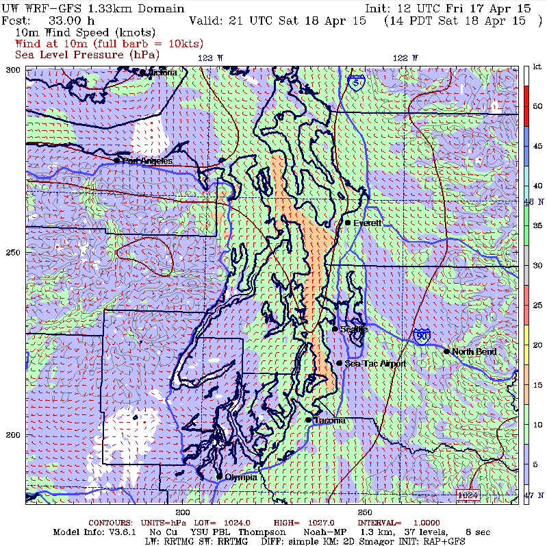
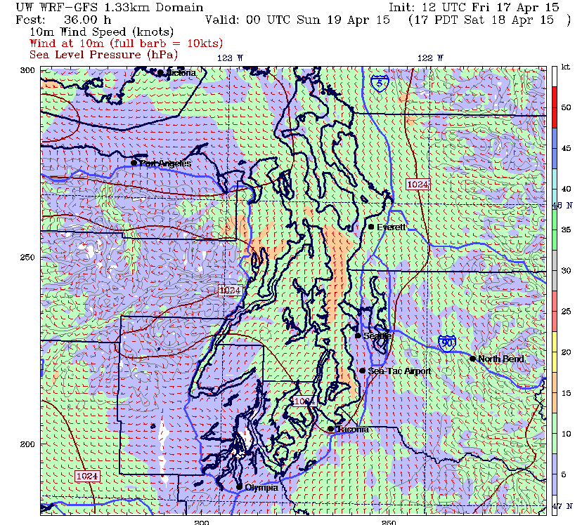
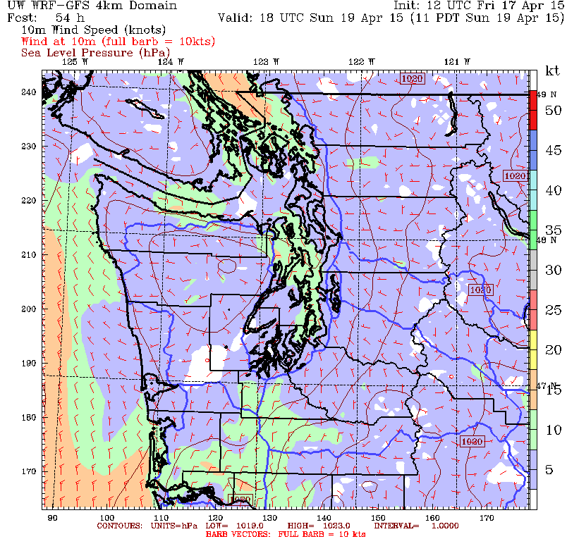
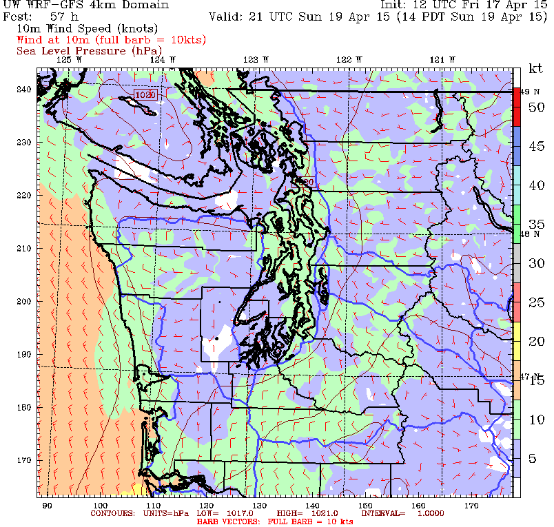
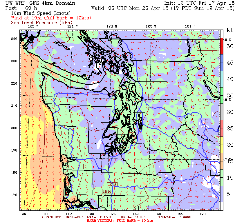
The good news is that as the day wears on, the breeze will settle into a more “normal” 340°-350°m and build to maybe 15-18 knots. Bring your foulies and bring your sunblock because this is gonna be fun. If they keep us out on the water to 1700 hours (slack tide), the wind will then start to clock back to the NNE. So watch that final run for the shift.
The gradient will ease even more on Sunday so while the pattern of starting with a NNE will be the same don’t expect the breeze to fill down the Sound with the tide to the extent that it will on Saturday. It will stay lighter and probably be even shiftier so if you thought it was tough on Saturday, you’ll love Sunday.
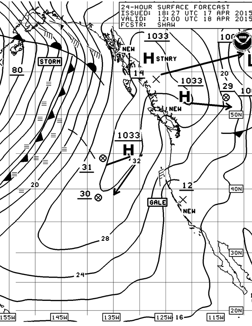
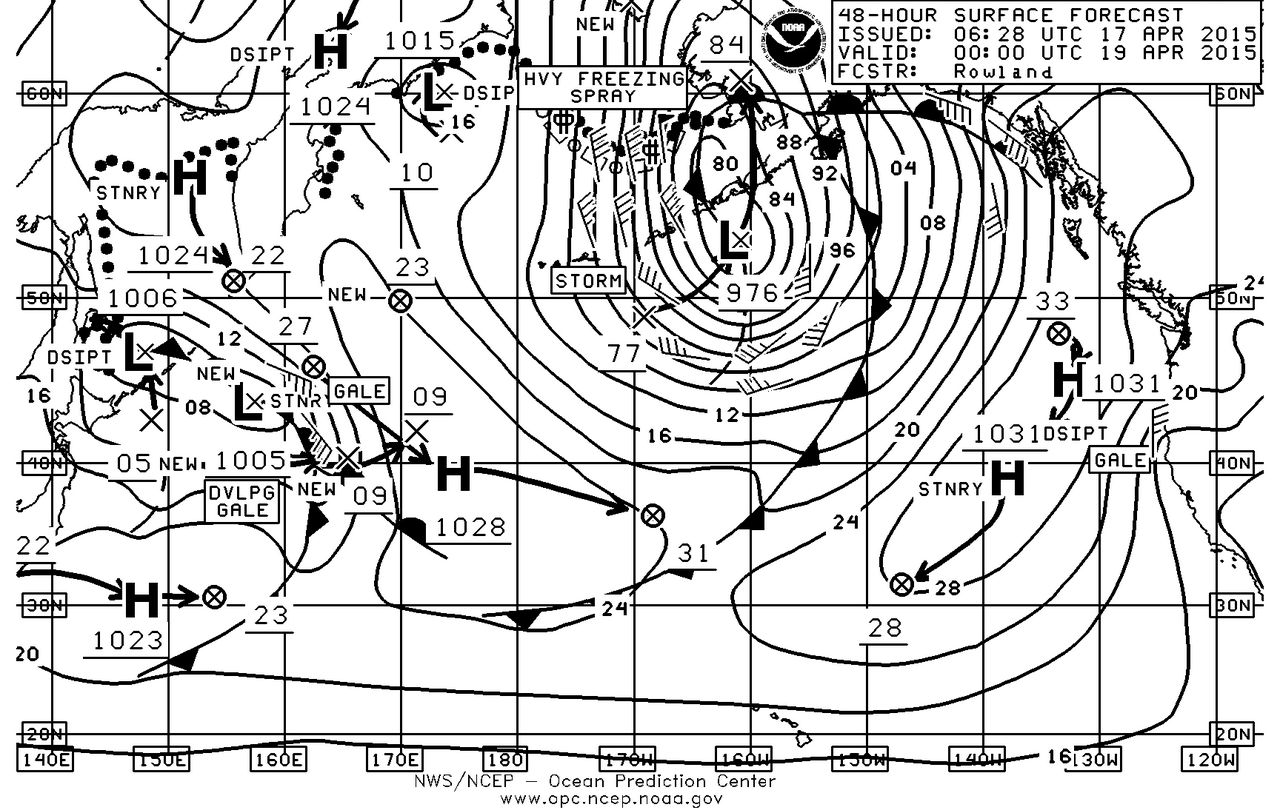
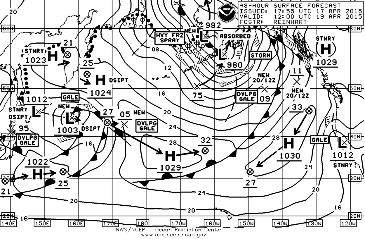
Before you leave the house both mornings check the gradient readings over the Northwest, check the weather at West Point and lastly check the Washington State Ferry Weather for real time conditions on the Edmonds-Kingston run.
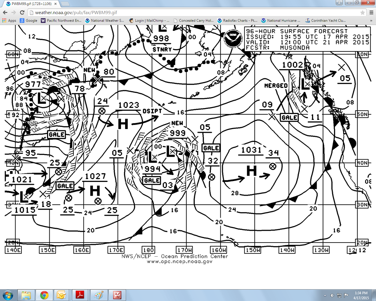
I also put the Tuesday Surface forecast chart in because it’s not too early to start tracking how the Pacific High is setting up especially if you’re going on TransPac this summer. As you can see it’s starting to assume a rounder and therefore more stable shape. At 1031mb it’s also about 10 mb below what it will be this summer. It’s also centered at 40N 150W which is where you’d expect to find it in late June and early July, certainly not this early. As the air warms over the northern hemisphere, the high will become stronger and more stable which will mean a warm summer with little rainfall for the Pacific NW and fast race for TransPac boats.
Good luck and enjoy the weekend.
