As we said last week, it was too good to last and sure enough the weather is turning more typical for springtime in the Pacific Northwest. That would mean rain every couple of days coinciding with frontal passage with cool, unstable conditions between fronts. For this weekend, and one of our favorite events, the Gig Harbor Islands Race, it will mean some challenging conditions on the race course.
Of course, you have to look at it in the big picture format and the best part is that you get to go to Gig Harbor. So regardless of what happens on the race course you’re still going to have a great time. As you pull into Gig Harbor there is the obligatory check-in with your friends at the Tides Tavern, then on to the Gig Harbor Yacht Club. Saturday after the race there’s the post race function at GHYC with FREE food, which is still a great price and all the endless sea stories about the race itself. All in all, not a bad way to spend the weekend.
Click on any image to enlarge.
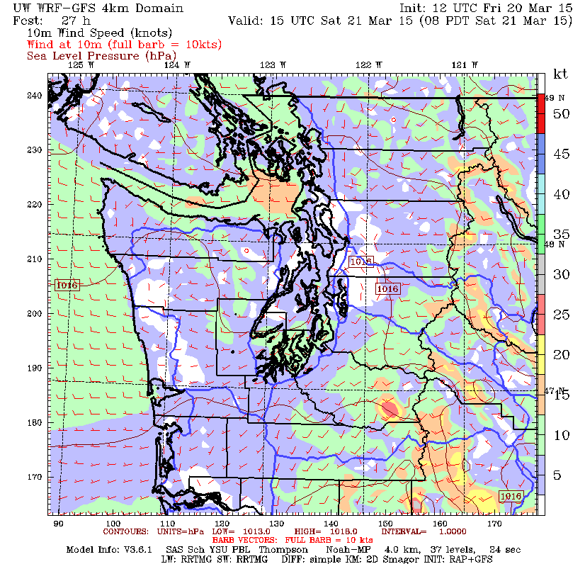
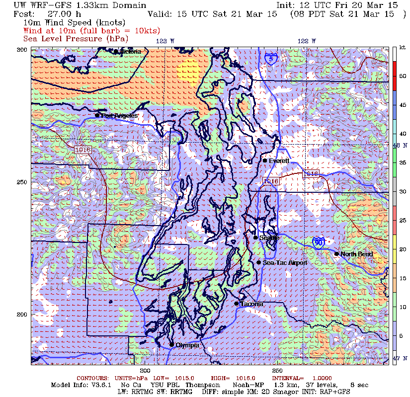
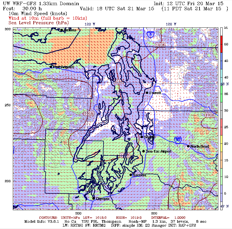

As you probably noticed, we started out reasonably nice today however we are now seeing the front come through and this will last through the evening and into tomorrow morning which means we’ll be in a post-frontal situation for the race tomorrow. The Saturday morning surface forecast chart shows the front in Idaho and a weak ridge of high pressure trying to establish itself over our area. It just won’t last very long and by Saturday evening it will start to degrade as you see another front moving towards the coast which will bring us rain on Sunday late afternoon and into the evening.
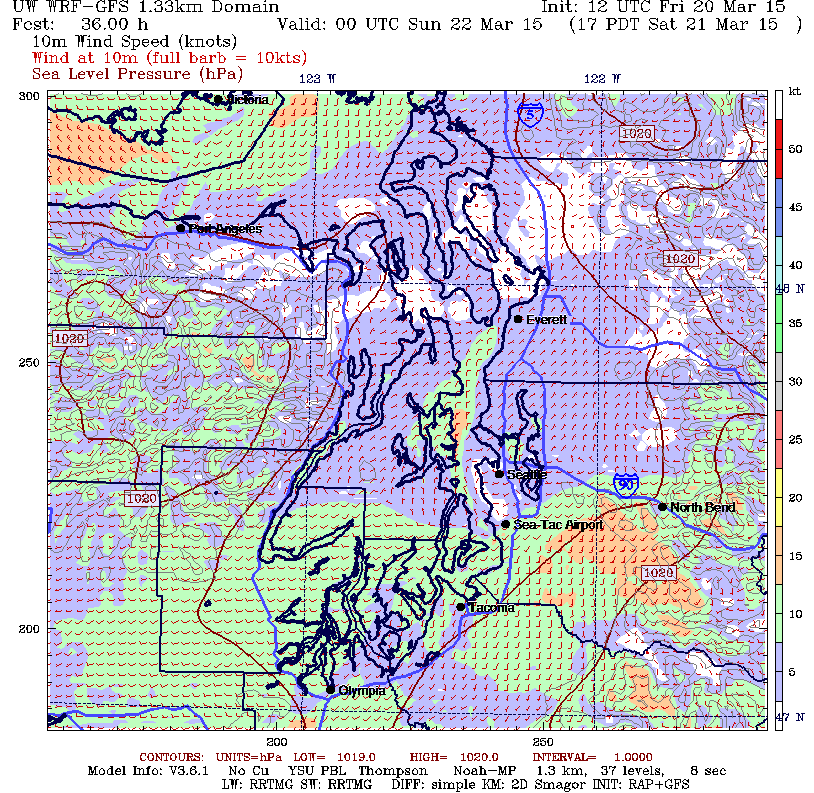
The Saturday morning 0800 MM5 4km view shows a classic post-frontal onshore flow with a more wind taking the path of least resistance down the Straits. It is also flowing around the bottom of the Olympics and forming a weak convergence zone from Elliott Bay to the south end of Whidbey Island. The good news is that there is a nice band of SW breeze over the race course which appears to hold most of the day. The real question is of course just how much breeze will there actually be in Colvos Passage? This is where the topography of the land masses surrounding Colvos come into play and unfortunately it looks like this may be a case of drag racing from hole to hole and trying to connect the puffs to make your way to the mark off the top end of Blake Island.
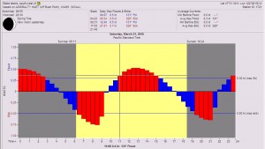
The tidal current at the station off of the SW corner of Blake Island is interesting because it shows the distortion caused by the constant current flowing north in Colvos Passage. Once you clear the north end of Vashon Island, that’s where you’ll hit the flood tide which will be in play in that area until about 1700 hrs.
This will probably be a downwind start and with the wind out of the southwest you will probably see the puffs come off the west side of Colvos and then touch down ¼ to ½ way across Colvos. You’ll want to stay in the puff and stay in the axis of the northward flowing current. This means you’ll want to meet the puff to the west of the axis, let the speed start to build on your boat before you start bear off, then sail down with the puff to east side of the axis of the current and before the breeze lifts off the water as it approaches Vashon, work your way back up to west side of the current axis. Since the bluffs on the west side vary in height the puffs won’t be coming down the same distance off the beach so once again your tactician will have to have his or her head on a swivel to watch what’s going on in front and in back of you to stay in phase.
The real challenge may come at the north end of Colvos. Remember that weak convergence zone we mentioned at the start of this? The typical post-frontal springtime tendency for CZ’s is to work south over the course of the day which means you may have a very light air reach in an easterly to a beat in a northerly to get to the top mark.
At the top end of Vashon you’ll want to work your way to a course that keeps you well off of the east side of Blake Island as while it may show wind right up to the beach there, it can be significantly lighter in there and the additional northward flowing current along that beach won’t make up for the lighter breeze. Looking to the north you’ll want to watch how the boats ahead of you round the mark. You’ll be rounding to port and the favored tack will most likely be starboard it’s just that if you can hold port tack for a short while to find a lane of clear air in which to tack that will be much better than trying to sail in dirt all the way back to Colvos Passage. Of course if you’re rounding in a northerly, you’ll probably want to plan for a starboard pole bear away set to get you away from traffic approaching the mark however you will need to be prepared to gybe as soon as you have a clear lane south.
The next challenge in a northerly will be the transition back to the southwesterly so watch to see how the boats ahead are making it. Generally speaking it pays to work to the west to stay out of the ebb coming up Colvos.
Once in Colvos, the challenge will be to stay out of the current while sailing on starboard for as long as possible. When the anti-water shows up, take a short tack back to west however don’t get too close to the light air that will be on the beach. The battle will be trying to find those clear lanes in which to sail. The other challenge will be to take advantage of the starboard tack lifts that will be found on the north side of the points sticking out into Colvos Passage. Your tactician will want to position you for this which will mean thinking two to four tacks ahead. Anticipate, anticipate, and anticipate.
This will be a challenging one and as always it should be a ton of fun. Have a great weekend!
