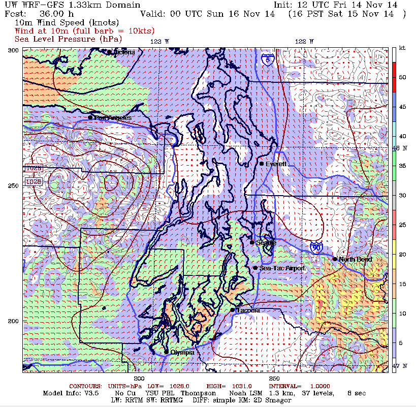
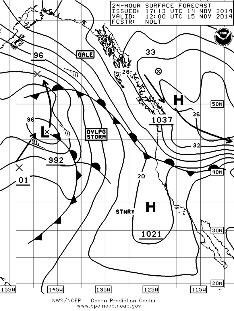
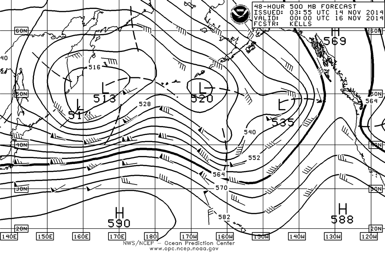
The weather words of this week and continuing through the weekend will be offshore flow. This is caused by a fairly strong high-pressure system (1037mb) that remains situated over the BC-Alberta border and is not about to move. In turn it sends the low pressure systems coming across the Pacific way up north where they pick up a lot of cold air and continue their journey back south into the central US making winter a brutally reality. This situation is known as an omega block. You can see from the 500mb (upper atmosphere) chart how it gets that name as the path the jet stream takes looks like the Greek letter omega Ω. The pressure gradient difference was huge earlier this week, which is what caused the wind to flow from the east to the west through the gaps in the Cascades and the Olympics with the wind being particularly strong in Cascade foothills near Enumclaw. This is going to continue through the weekend however we won’t see the very high winds we had earlier this week. You will see stronger than normal easterlies in the San Juan Islands, as the breeze comes down the Fraser River Valley and goes out the Straits of Juan de Fuca. You’ll also have stronger than normal easterlies in the south Sound as the easterly comes through the gap at Enumclaw and flows out the Chehalis Gap into the Pacific Ocean via the Grays Harbor area.
If you’re sailing, you’ll notice a more pronounced shift in the puffs to the north-northeast. In the central Sound your breeze is likely to be light and variable as the Cascades will be acting as a block. Tides are fairly moderate this weekend with the biggest tides of November coming at the end of the month and the biggest tides of the year coming at the end of December and we will talk more about that next week.
The Sunday surface chart is just one of those amazing winter phenomena where we have no less than NINE separate low-pressure systems lurking in the Pacific. At the eastern margin of the chart you can see that our blocking high-pressure system has drifted slightly to the south however it has also strengthened to a 1040mb high which would even be high for a summertime high-pressure system. In other words this pattern is going to hold for a while longer with any low pressure systems trying to come ashore being weakened and driven north of us.
Enjoy the weekend!


